Page 2 of 3
Data storing
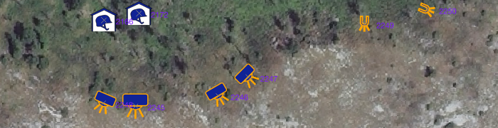
The data collected with QRex are stored in the TRS database (see licence and installation). The additional data, like background images, delimitations or other pre-existing data can be stored in the database or provided by other sources. When opening the project, the data present in the database are displayed in the window canvas.
Positioning
The geo-localisation can be achieved in two ways:
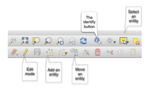
- With a GPS device connected to the computer or contained in the computer. In this case the connection has to be activated on a layer in 'edit' mode with the relevant menu (see QGis doc for the settings).
- With a background image, like an aerial photo or a connection to a map server. In this case toggle the layer that will receive the data in edit mode and point with the cursor where the object is located on the image.
Some basic QGis tools